


- Home
- Products
- Industrial Services
- CoRo Digital Company
- Customized design of SLAM navigation software for AGV self-propelled vehicles

CoRo Digital Company
Customized design of SLAM navigation software for AGV self-propelled vehicles
Share:



Product Description
Introduction to SLAM
Simultaneous localization and mapping
AGV/AMR (Automated Guided Vehicle) transporter, laser navigation, map positioning and navigation.
Lidar Slam Navigation
- SICK LiDAR or PEPPERL+FUCHS LiDAR
- Positioning accuracy (+/-) 2cm, Enable OdoFilter (+/-) 1cm
- AMR AGV moving speed 1m/sec
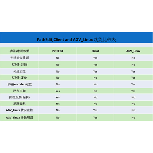
- Path planning can choose between multiple paths (PathLink) or the shortest route between points A and B.
- Forward, backward, rotate in place, obstacle avoidance distance adjustment
- The lidar can be configured with a single lidar or dual lidars for positioning.
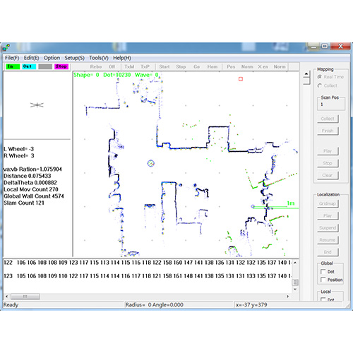
- Two mapping methods are provided: (1) real-time mapping and (2) mapping based on data calculations after data collection.
- Map data can be exported and imported into a Text File.
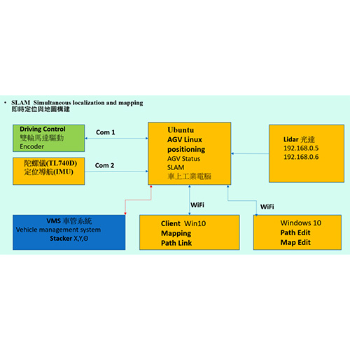
- Supports wheel positioning Odometry, encoder and gyroscope (TL740D) positioning and navigation (IMU)
- Supports reflector positioning
- Supports ten maps, which can be used by floor.
- Supports LoopClosure map error correction
Contact Us
If you have any suggestions or advice, please leave your valuable information and we will reply to you as soon as possible.